The French motorway network comprises several tens of thousands of kilometers of both toll and non-toll roads, with varying pricing structures, toll systems, and levels of service area equipment that differ significantly from one section to another. Reading a map of toll highways and rest areas requires understanding what the pictograms represent: type of barrier, operator, available services, and actual spacing of stopping areas.
Free-flow tolling and gantries: what traditional maps do not show
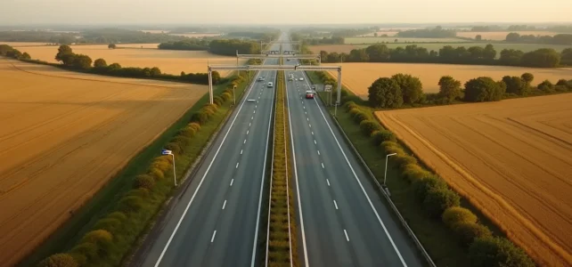
The distinction between barrier tolls and free-flow tolling radically changes how a journey is planned. On a traditional map, each toll station is represented by a fixed symbol. In free-flow, there is no physical barrier: gantries detect the vehicle and payment is made afterward.
Recommended read : Optimize Your Career with the AC Amiens Intranet and the Arena Portal: Practical Guide
Since 2022, several sections have switched to this system. The A79 (RCEA), A837, and portions of the A4 (Boulay sector) operate on open-road tolling. The French network now combines classic “point tolls” with free-flow segments, rendering any map that merely locates the old barriers obsolete.
To anticipate the actual cost of a journey, we recommend cross-referencing the location of the gantries with the toll simulators provided by the operators. A detailed map of highways in France that incorporates these new collection points helps avoid unpleasant surprises when receiving a delayed payment notice.
Further reading : Discover the secret coves and beaches of Lake Bourget for an unforgettable summer
Free-flow also raises a practical question for foreign vehicles or occasional drivers: without a toll badge, payment must be made online within a constrained timeframe to avoid penalties. This parameter does not appear on any paper map.

Cost per kilometer on the motorway: disparities between toll axes
Not all kilometers of motorway are financially equal. According to available data, the average cost of a toll kilometer is around 0.09 euros, but the actual range varies significantly from one section to another.
The discrepancies can be explained by several factors:
- The age of the concession: sections that have been amortized for a long time maintain moderate rates, while newer sections (A65 Langon-Pau, A79) apply higher rates to finance the initial investment.
- The terrain crossed: alpine or Pyrenean motorways incorporate the additional costs of infrastructure (tunnels, viaducts) into their per-kilometer pricing.
- The operating concessionaire: APRR, Vinci Autoroutes, Sanef, and other companies set their prices according to negotiated planning contracts with the state, with distinct schedules for increases.
On a long-distance journey, the difference between a route passing through expensive sections and an alternative route via free motorways (A75, portions of the A20) can represent several tens of euros. Identifying these free sections on the map before departure remains the most direct way to save money.
Rest areas and service areas: actual spacing and levels of equipment
Regulations require a rest area approximately every fifteen kilometers on the toll network. In practice, this spacing varies by section and traffic density. Rest areas offer minimal facilities: restrooms, picnic tables, and sometimes a play area.
Service areas, which are more spaced out, concentrate gas stations, restaurants, shops, and electric charging stations. More than fifty brands are present at the rest areas on the toll network, but the quality and diversity of the offerings fluctuate significantly.
A point rarely mapped concerns the price gap between rest areas and off-highway businesses. This gap regularly reaches several tens of percent on food and fuel. Maps that indicate the proximity of an exit with businesses accessible within a few minutes provide high-value information for budget-conscious drivers.

Charging stations on the motorway: a recent mapping criterion
The deployment of fast charging stations at motorway rest areas is transforming how maps are read for electric vehicle drivers. Not all service areas are yet equipped, and the available power (50 kW, 150 kW, 300 kW) directly affects the stop duration.
We observe that the most useful maps are those that overlay the location of the charging stations, their power, and their real-time availability. This filter did not exist a few years ago and is becoming a selection criterion for choosing one’s planning tool.
Free motorways in France: sections to identify on the map
Several French motorways are completely free and provide credible alternatives to toll routes on certain corridors. The A75 (Clermont-Ferrand – Béziers) remains the best-known example, with a route crossing the Massif Central without any barriers, except for the Millau Viaduct (subject to a specific toll).
Other free sections exist on the A20 (Vierzon – Brive), on suburban portions of the A1, A6, or A7 near major metropolitan areas, and on certain urban bypasses. These sections are rarely highlighted on the concessionaire maps, which logically focus on the toll network.
For a north-south journey, combining the free A20 to Brive and then the free A75 to the Mediterranean coast allows crossing France while only paying one occasional toll. This type of route is only clearly visible on a map that visually distinguishes between toll sections and free sections.
Reading a motorway map becomes more relevant when it simultaneously integrates the layout of the roads, the type of toll, the level of service area equipment, and the presence of charging stations. Tools that overlay these layers of information on a single medium are gradually replacing the juxtaposition of multiple sources, and it is precisely this convergence that makes a difference in planning a long-distance journey.